Note: Lana Cohen is a Report For America fellow covering the environment & natural resources for TMV & KZYX. Her position is funded by the Community Foundation of Mendocino, Report for America, & our readers. You can support Lana’s work here or email [email protected]. Contact Cohen at LCohen@mendovoice.com. TMV maintains editorial control.
The County of Mendocino is holding two “Local Assistance Centers” for people and businesses that were impacted by the August Complex of Oak Fires. For more information, you can see the full press release here or call 707-463-4441.
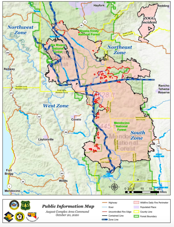
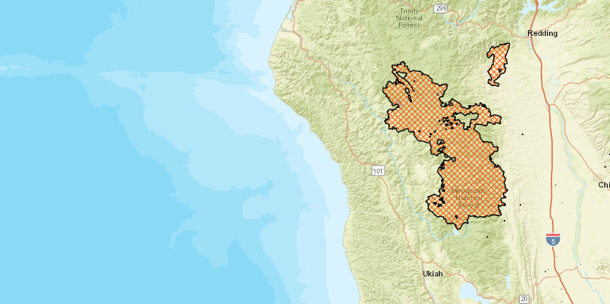
10/21/2020 — The largest fire in California history is almost completely extinguished, with perimeters largely secured and only a few hotspots left. After more than two months burning, the August Complex is 91% contained and the smoke it brought to surrounding areas has lifted.
The Glass Fire is also on it’s way out. Yesterday, Cal Fire declared the destructive fire, which burned in Napa Valley for most of the month, 100% contained.
Although parts of the August Complex will smolder until the arrival of significant rain, the US Forest Service feels confident that the fire lines they put in will hold.
In the Forest Service’s morning report on the complex, they say that in the areas where the fire is contained, the lines have been secured, and that there are no meaningful hotspots near the fire border. “The fire is contained inside the perimeter and does not have adequate fuel in the buffer zone to escape containment,” they wrote.

Although the fire has largely burned out, there is still work to do. Yesterday, the Mendocino Executive Office announced that the county will be holding two local assistance events next to provide resources to people and businesses impacted by both the August Complex and the Oak Fire. You can find more information here.
This morning, Mendocino County Sheriff Matt Kendall downgraded all remaining evacuation orders to evacuation warnings and lifted evacuation warnings in five zones. The latest evacuation map for Mendocino can be found here.
Three zones remain under evacuation order:
Zone E, described as south of the Mendo-Trinity county line, east of the Mendocino National Forest boundary, north of Bar Creek, and west of the County Line near the M2.
Zone N, which includes the area north of the Middle Fork Eel, including the Eel River Ranger Station and Black Butte Store, west and south of the Mendocino National Forest boundary, and east of Williams Creek.
Zone E1, which encompasses the area north of Mendocino Pass Road, or Forest Highway 7, east of the Middle Fork Eel, south of Bar Creek and west of Nebo Rock, also remains under an evacuation warning.
There are currently no road closures in Mendocino County.
In Trinity County near the north zones, the area of Bear Wallow remains under evacuation order. In Kettenpom and Zenia, the area south of Zenia Bluffs Road, West of the Zenia Lake Mountain Road, and south to the Mendocino-Trinity County border and Friend Mountain are still under evacuation warning.
In Trinity, Highway 36 is still closed from South Fork Mountain Summit to the California state route 3 intersection. However, cars are allowed to pass through following a pilot car. The pilot cars are escorting traffic through the area twice a day at 7 a.m. and 5:30 p.m.
In the Northwest Zone, firefighters are mopping up the fire, which is 119,401 acres and 94% contained. The last uncontained section of perimeter is near Bradburn Creek and Coffee Pot.
In the Northeast Zone, which is 272,089 acres and 90% contained, firefighters are also doing patrol and mop up, working on containing the areas near Beegum Creek, Irish mountain, and Progeny.
The same is to be said for the South Zone, which is 499,830 acres and 91% contained.
At this point, Cal Fire and the US Forest Service are pulling out resources and sending them to be checked for functionality and then handed over to teams fighting other emerging and large fires around the state and the country.


