MENDOCINO CO., 8/14/18 — Although the River Fire and the Ranch Fire began within an hour of each other on July 27, they have had very different outcomes. The River Fire was declared 100% contained yesterday, while the Ranch Fire has become the largest fire in recorded state history in its own right, and claimed the life of Battalion Chief Matthew Burchett yesterday. Over the last 24 hours, the Ranch Fire has remained quite active along its northern flank, with new mandatory evacuations issued in Glenn County — meaning that the Mendocino Complex fires have now forced people to flee their homes in four different counties across California.

Draper City Battalion Chief Matthew Burchett, who perished fighting the Mendocino Complex.
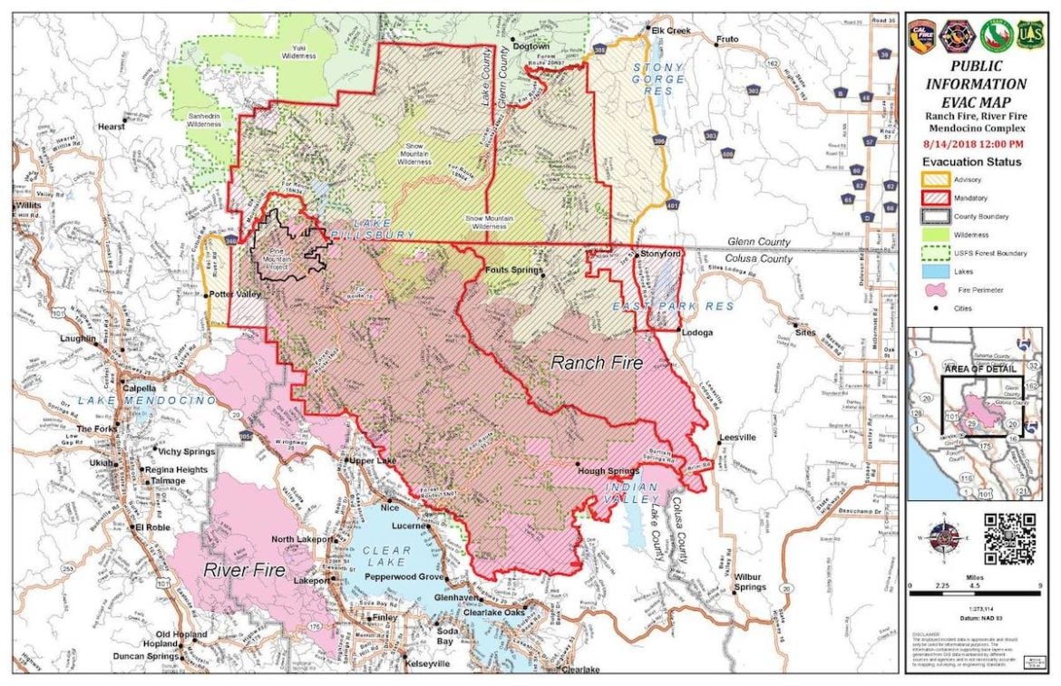
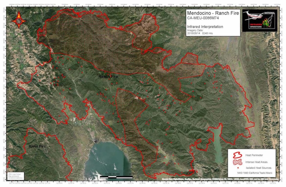
The Ranch Fire reached a total of 305,990 acres this evening, with containment at 64%, and continues to make its way further north into the Mendocino National Forest. Between Monday and Tuesday mornings the Ranch Fire grew around 10,000 acres in 24 hours, and was 305,440 acres in size and 68% contained as of this morning’s CalFire update. There has been no movement along the fire’s southern edge, and patrol and suppression efforts are continuing there. The fire is effectively entirely contained from Potter Valley in the west, along Hwy. 20 all the way to Clearlake Oaks and on into Colusa Co.
This has been an extremely intense fire season in California, and it is nowhere near over. So far this fire season, a total 4,168 fires have burned 726,329 acres across California — between the beginning of the year and August 12 — nearly three times the 225,744 acres burned by wildfires in 2017.
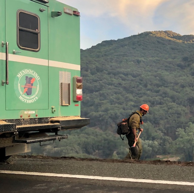
More than 3500 personnel are currently battling the Mendocino Complex fires, including “41 firefighters from Australia and New Zealand and 200 active duty military firefighters from the 14th Brigade Engineer Battalion.” That number is down a few hundred from earlier in the week as the River Fire has been contained and did not move for several days prior.
On both the northeastern and northwestern edges of the Ranch fire, where there are more residences, crews are scouting and prepping for structure defense operations while also constructing and strengthening control lines to conduct firing operations over the next several days.
On Monday evening, fire crews “conducted a successful burning operation along the fireline between Mid Mountain Road and Eel River west of Lake PIllsbury,” according a Facebook post by the USFS. There have been some reports from Josh Stone, who works at the Lake Pillsbury Resort that the fire has damaged some residences in the Rice Forks area, but crews are still working on structure defense in that area. Crews are also building contingency dozer lines beyond the north bank of the Eel River, in case the fire jumps the river, and around Lake Pillsbury Resort.
The fire has come very near to the Scott Dam, which is the a large concrete dam that holds back the waters forming Lake Pillsbury. The dam is owned and operated by Pacific Gas & Electric, though there are no transmission lines in that area, and the dam is not a hydroelectric dam. PG&E spokesperson, Deanna Contreras, said that the company is working with firefighting crews in the area, but that there is no substantial danger to the dam or other key infrastructure. Said PG&E
“However, the dam itself does not generate power and PG&E does not provide power to the Lake Pillsbury area. There is NOT a lot of vegetation near the dam. The dam is concrete and sitting in water. We have, though, taken precautions to protect the facilities and outbuildings in the area, including clearing vegetation and pre-treating all buildings with fire retardant to minimize damage if they come into the fire’s path.”
Here’s the description of the firefighting activities from the USFS on Tuesday morning:
On Monday, firefighters improved the dozer line along Gilmore Ridge and north through the 2012 Mill Fire scar toward Davis Flat. The operation went well and the line is holding. Good progress was made constructing dozer line along Bushy Camp and Noel Ridges. This has become the main fireline on the north end of the fire. A new dozer line was started from Lake Pillsbury along Cabbage Patch Ridge toward Little Round Mountain. Crews patrolled and extinguished hotspots in the Rice Fork Homes and Pillsbury Lake areas. This area remains under a mandatory evacuation order. Air tankers and helicopters were used to support firefighters on the ground.
Tuesday, firefighters will hold and improve the dozer line along Gilmore Ridge and north through the 2012 Mill Fire scar toward Davis Flat. Construction of the dozer lines along Cabbage Patch, Bushy Camp and Noel Ridges will continue. Crews will patrol and look for hot spots in the Rice Fork Homes and Pillsbury Lake areas. This area remains under a mandatory evacuation order. Work will continue on the construction of a contingency line west of Stonyford to Black Diamond Ridge.
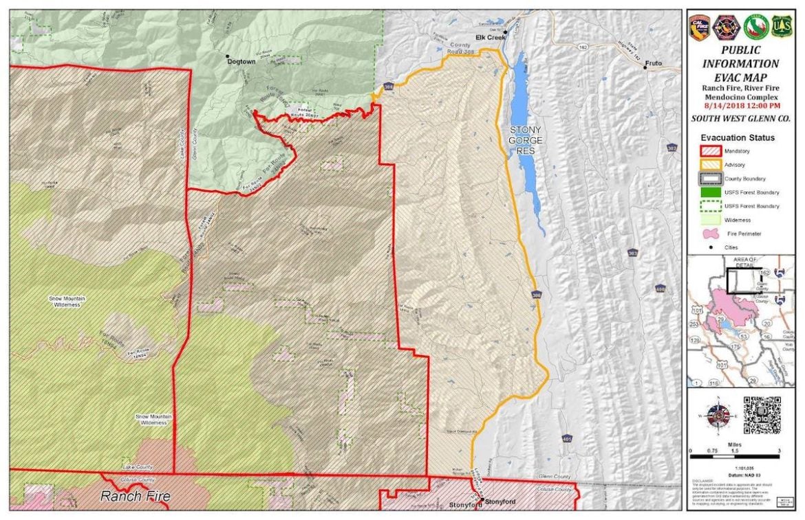
New mandatory evacuations were ordered in Glenn County today, as the fire was active on the northeastern front. The USFS also ordered a portion of the Mendocino National Forest closed, including:
Evacuation notice has been upgraded to Mandatory Evacuation Order for the Pleasant Valley area of the Mendocino National Forest land located in the southwestern Glenn County. The area included in this order is the Mendocino National Forest boundary west to the Lake County line, south to the Colusa County line and north to Forest Road 20N07 also known as County Road 308. Residents in this area should evacuate due to threat from Mendocino Complex Fire. Visitors, hunters, and campers should not access the affected area of the Mendocino National Forest until this Order has been lifted and the area is deemed safe.
The following roads are closed as a result of this order:
- Forest Road 20N07 Road at forest boundary
- Forest Road 18N38 Road at the forest boundary
- Black Diamond Road at the Forest Boundary
Areas east of the Mendocino National Forest boundary to County Road 306 and north to County Road 308, including the town of Elk Creek, remain in Advisory Evacuation Notice.

August 14 map of the Mendocino Complex.

August 14 Mendocino Ranch Fire map 9 am.

Glenn County evac map made August 14 at 12pm.
Kate B. Maxwell, [email protected].


