

This is a developing situation and information may change. We’ll update this article as more information becomes available. The most recent information will be updated at the top of the article, with the earlier reports below.
3/15/23 1:00 p.m. – All state roads are open in Mendocino County. Drive safe!
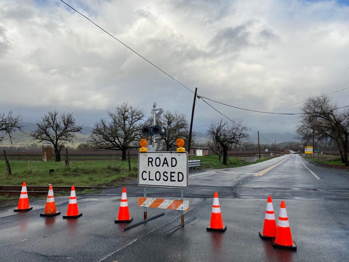
3/14/23 4:37 p.m. — The Garcia River has reached flood stage and is impacting State Route 1. As a result, State Route 1 is now closed in both directions between just north of Lake Ave. in Point Arena to Miner Hole Dr. State road conditions can be monitored here.
3/14/23 4:30 p.m. — Caltrans has closed State Route 175 in Hopland between U.S. Route 101 and Old River Rd. due to the Russian River flooding roadways. The river reached minor flood stage at 15 feet this afternoon. It is currently at 16.08 ft. and is expected to crest at 16.7 feet this evening. Please respect all road closures and if faced with flooded roadways, turn around – don’t drown.
MENDOCINO Co., 3/14/23 – An atmospheric river continues to hover over Mendocino County, bringing heavy rain, high winds and flooding. Reports of mud and rock slides and downed trees and power lines have dotted the transportation landscape since this morning, Tuesday, Mar. 14. Avoid unnecessary travel if you can as road conditions continue to be treacherous countywide.

A flood watch is in effect across the county until 5 a.m. Wednesday, Mar. 15. National Weather Service Eureka (NWS Eureka) anticipates that “excessive runoff may result in flooding of rivers, creek, streams, and other low-lying and flood-prone locations.” This includes urban areas, locations with poor drainage, and low-water crossings.
NWS Eureka predicts the Russian River near Hopland will reach minor flooding stage at 15.1 feet later today, Tuesday, Mar. 14. The Navarro River is currently flooding State Route 128, resulting in closures from State Route 1 to just west of Navarro. Caltrans reports that the Garcia River continues to rise along State Route 1 near Point Arena. Comptche Volunteer Fire Department reports that parts of State Route 1 may close due to the river flooding this afternoon. We will keep you updated if it closes.
Additionally, a wind advisory is in place until 5 p.m. today, Tuesday, Mar. 14. The county may see southerly winds between 15 and 25 mph with gusts up to 50 mph. High winds can blow around unsecured objects, bring down trees, and cause power outages.
Over 1,000 PG&E customers are without power across the county. The largest outages are in the Albion area (915 customers). PG&E cites an “equipment issue” as the cause of the outage. No estimated time of restoration is available. To the south, over 900 customers in Sea Ranch are without power, also caused by equipment and with no estimated time of restoration. You can check for individual outage information on the PG&E outage map here.
Thankfully, tomorrow will bring a break from the wet weather, with mostly clear conditions and highs in mid-50 to low 60 degrees.
Mendocino County’s many microclimates mean the weather conditions may vary based on your location, especially by elevation. You can check for the specific forecast for your neighborhood and on current road conditions as they develop. If you’re interested in an overview of the statewide impacts of the storm from a meteorological perspective, we recommend checking out Daniel Swain of Weather West, who has been sharing information throughout these major weather events.
Information changes rapidly, and we’ll be keeping you updated on current conditions throughout the next several days. Although local agencies are preparing for the storm, emergency resources are likely to be stretched thin — if you can avoid travel, please stay off the roads.
You can read more about the storm’s original forecast in our previous article about this storm, and be sure to bookmark our winter weather information guide. There are additional resources included at the bottom of the article so you can check the exact conditions in your area.
Mendocino Voice Winter weather resources:
- Our guide for winter weather emergency and preparedness info — we recommend you bookmark this
- Check your specific forecast at this link along with the National Weather Service advisories and warnings, as well as their Facebook page and their Twitter page
- Check the CalTrans QuickMap for current road closures or call 1-800-GAS-ROAD
- Check for current accidents at the CHP traffic update page
- Caltrans traffic cameras can be seen here, and here are the PG&E cameras
- You can also check out the Weather Underground to look for weather stations in your area
- Check the PG&E current outage map to find or report power outages
- NWS has flood stage predictions here; and you can find USGS current streamflow information here
- NWS is seeking snowfall reports, and you can submit them to this website.
- We recommend meteorologist Daniel Swain’s Weather West Blog as a good place to find more in-depth current weather analysis