This is a developing situation and information may change. We’ll update this article as more information becomes available. The most recent information will be updated at the top of the article, with the earlier reports below.
1/12/23 11:45 a.m. — According to the U.S. Forest Service, “Mendocino Pass Rd FH7 in Glenn Co is now open. The FH7 in Mendocino Co is closed at mile 15.5. Until the storms end, it is best to avoid travel. If you must enter the forest, be sure to check our road conditions page.” That page can be found here: http://bit.ly/MNFRoads
The National Weather Service has shared this morning’s risk assessment for Mendocino County, with today through Saturday as having “minor risks,” and the low risks on Sunday and Monday — you can check that out:
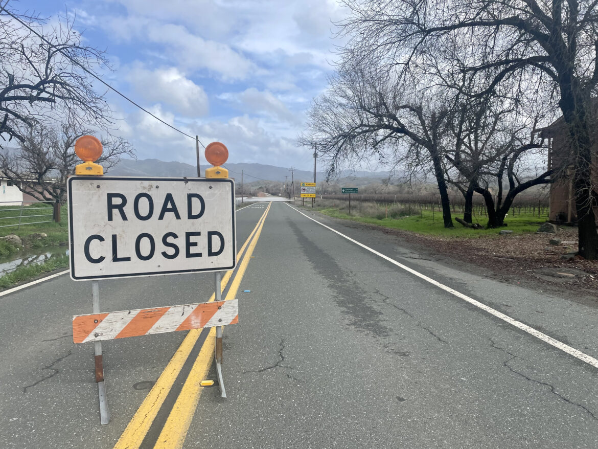
1/12/23 8:38 a.m. — SR 175 is closed from Highway 101 to East Side Rd./Old River Rd. due to flooding. There is no estimated time of reopening.
The White House extended federal assistance to 10 additional California counties that have been impacted by the recent winter storms, including Mendocino, by amending its recent Emergency Declaration. This will enable FEMA to provide on-the-ground and fiscal resources and services to help county residents and agencies recover.
A National Weather Service Wind Advisory is in place for the Mendocino Coast and select inland areas including northern and central Mendocino County until 3 a.m. Friday. Residents from Leggett to Potter Valley, and the entire coast, can expect southeast winds 25 to 35 mph with gusts up to 60 mph. Additionally, a High Surf Advisory goes into effect at 1 p.m. through 10 a.m. Friday for the coast. The coast is anticipated to experience “dangerous surfing conditions and localized beach erosion” due to “large breaking waves up to 23 feet.”
Thankfully, Mendocino County and most of the North Coast and our North Bay neighbors will experience a break in the weather today, Thursday. While winds will remain gusty, this afternoon will bring temperatures just below 60 resulting in a good day to clean up the yard and enjoy any outdoor activities (just avoid beachcombing on the Coast due to high surf!) until rain returns this evening, after 5 p.m. National Weather Service Eureka expects another atmospheric river to return on Saturday with thunderstorms in tow. We’ll keep you posted on the latest forecasts as more information comes in.
1/11/23 4:20 p.m. — Individuals and business owners in Mendocino County who have been impacted by the recent storms qualify for an extension (May 15) to file their taxes and tax payments with the Internal Revenue Service (IRS). Impacted individuals will also have until May 15 to make final IRA and health savings account contributions. Learn more here.
The California Arts Council created a list of resources for artists, museums, musicians, art galleries and other creative organizations and occupations impacted by the storms.
1/11/23 3:06 p.m. — The National Weather Service Eureka (NWS Eureka) reports that the heaviest rainfall is expected late this afternoon and tonight. NWS Eureka also reports that thunderstorms are heading towards the Mendocino Coast, which may lead to possible isolated thunderstorms on coastal waters and land areas tonight. Residents should expect heavy rain to accompany any thunderstorm. Additionally, a Wind Advisory that was set to expire Thursday afternoon for the Mendocino Coast has been expanded to include the coast and northwestern Mendocino County. It will expire 3 a.m. Friday.

1/11/23 1:30 p.m. — The Point Arena Lighthouse remains closed due to weather and road conditions. The Point Arena Lighthouse Keepers, the nonprofit that operates the lighthouse, shared on Facebook that they have stopped taking lodging reservations through January 12, with a possible extension depending on the weather. The Keepers hope to reopen the light station for tours starting January 13. They will change that date if volunteers are able to perform necessary repairs to the property, specifically broken fences and the removal of downed trees.
1/11/23 12:50 p.m. — A tow truck is going to need a tow after it slid off the road while traveling on Highway 101 on the Willits Grade. CHP Ukiah announced that a northbound lane of Highway 101 would be closed to clean up the scene and remove the truck from the shoulder. The driver of the Willits-based T and T Towing company truck was not seriously injured.
1/11/23 12:14 p.m. — Point Arena City Council will meet for a Special Session at 5 p.m. on Thursday to receive updates about the recent storms from local law enforcement and first responders and to ratify the Declaration of Local Emergency issued on January 8. The meeting will be held in person at City Hall, 451 School Street and online via Zoom at https://zoom.us/s/84888251095. Find the agenda here.

1/11/23 11:28 a.m. — The Sonoma County Sheriff’s Office reported this morning that a car was found submerged in flood waters along Trenton-Healdsburg Rd. in Forestville in Sonoma County. The body of Daphne Fontino, a 43 year old Ukiah resident, was found Inside the vehicle. This is a developing story and we will update as more information becomes available. NBC Bay area has this report.
MENDOCINO Co., 1/11/23 – Mendocino County woke up to a fourth atmospheric river this morning without a moment to dry out between the last one. This storm brings another round of what the National Weather Service calls “excessive rain on already saturated ground” that “may produce more flooding.” The county should be prepared for just that: more rain and wind that could result in more flooding, downed trees, and power outages. The Mendocino Voice team will be reporting live on conditions. Latest updates will be posted above!
The National Weather Service Eureka (NWS Eureka) reports that Mendocino County will experience “another period of moderate to occasionally heavy rainfall” Wednesday. As a result, NWS Eureka once again issued numerous advisories and watches county-wide, from the coast to inland regions. Here’s what to expect in the next 24 hours.
NWS Eureka forecasts that the county may see rainfall ranging from 1.23” in Covelo to 1.97” in Point Arena now through 4 a.m. Coastal areas, Laytonville, Leggett, Willits and portions of Anderson Valley may experience isolated thunderstorms tonight through early Thursday morning. Remember, when thunder roars, go indoors!

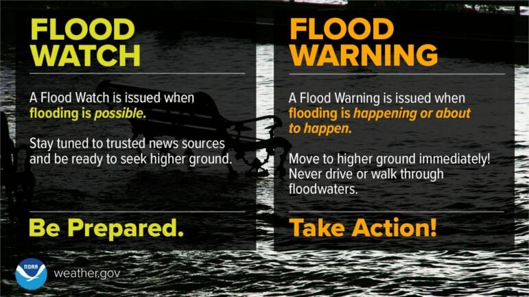
And with all that rain comes more floods, which leads to unsafe driving conditions, more road closures, and other hazards. A Flood Watch is in place for the entire county through early Thursday morning. We can expect to see more flooding of rivers, creeks, streams, and other low-lying and flood-prone areas, including the potential closure, again, of State Route 1 at the Garcia River, SR 128 near Navarro, and SR 175 in Hopland due to river flooding. And it’s not just the rivers: culverts, storm drains and ditches will likely overflow again in urban areas.
Due to concerns of flooding at the Navarro and Russian rivers, NWS Eureka issued a Flood Warning for both, which means flooding is already happening or will happen soon. The Navarro River near Navarro is forecast to hit 24.1 ft. early Thursday morning, a touch over its 23 ft. flood stage. NWS Eureka is also concerned that SR 222, Talmage Road, near Ukiah could see minor flooding from the Navarro. The Russian River near Hopland can expect to exceed its 15 ft. flood stage at 16.8 ft. tonight. As for the Garcia River, it could reach 10.2 ft. at 7 a.m. on Thursday, one foot below the 11 ft. reached on Monday that resulted in the closure of Highway 1.
A Wind Advisory starts at 10 a.m. on Wednesday through 4 p.m. Thursday for the Mendocino Coast. Coastal communities could experience 20 to 30 mph winds with gusts up to 55 mph. While the advisory is only for the coast, inland residents can expect winds from 16 to 26 mph with gusts up to 38 mph.
Information is changing rapidly, and we’ll be keeping you updated on current conditions throughout the next several days. Although local agencies are preparing for the storm, emergency resources are likely to be stretched thin due to the historic conditions — if you can avoid travel, please stay off the roads for everyone’s safety.
You can read more about the storm’s original forecast in our previous article about this storm, and be sure to bookmark our winter weather information guide. There are additional resources included at the bottom of the article so you can check the exact conditions in your area.
Sandbags are available at the following locations, according to Mendocino County:
- Friedman’s Home Improvement in Ukiah
- Hopland Band of Pomo Indians located at the corner of Hwy 101 and Hwy 175
- Redwood Valley Fire Station
- The Willis Justice Center located at 125 E Commercial Street in Willits
- Laytonville Fire Station
In Gualala, the South Coast Fire Protection District (SCFPD) is distributing emergency go-bags. Provided by PG&E and the Mendocino County Operation of Emergency Services, the bags include a blanket, granola bar, chips, water, gummy snacks, and a portable power station to keep your phone charged. First come, first serve at 39215 Church St., Gualala. SCFPD also has generators on hand for some residents experiencing extended power outages. Contact Jason Warner at 707-391-5772 for more information.
Mendocino Voice Winter weather resources:
- Our guide for winter weather emergency and preparedness info — we recommend you bookmark this
- Check your specific forecast at this link along with the National Weather Service advisories and warnings, as well as their Facebook page and their Twitter page
- Check the CalTrans QuickMap for current road closures or call 1-800-GAS-ROAD
- Check for current accidents at the CHP traffic update page
- Caltrans traffic cameras can be seen here, and here are the PG&E cameras
- You can also check out the Weather Underground to look for weather stations in your area
- Check the PG&E current outage map to find or report power outages
- NWS has flood stage predictions here; and you can find USGS current streamflow information here
- NWS is seeking snowfall reports, and you can submit them to this website.
- We recommend meteorologist Daniel Swain’s Weather West Blog as a good place to find more in-depth current weather analysis
Sarah Stierch covers wildfires, breaking news, and more for The Mendocino Voice. You can follow Stierch on Twitter and learn more about her work and donate to her directly at here. Contact Stierch at [email protected]. The Voice maintains editorial control and independence.


