UPDATE 10/25/21 10:05 a.m. — State Route 1 has re-opened after flooding in the roadways has receded.
UPDATE 10/25/21 12:30 a.m. — The flood warning has been extended by NWS for the Russian River near Hopland has been extended until 3:30 a.m. and flooding may occur in the vicinity of SR 175 in Hopland.
UPDATE 11:45 p.m. — NWS Eureka has released the rainfall totals for the last 24 hours, and Yorkville exceeded any other location measured in Mendocino County by four inches with a total of 12.61 inches of rain measured. Redwood Valley had the next highest amount of rainfall. SR 1 remains closed at the Garcia. According to the NOAA river gauges the Russian River (check levels here) has exceeded the flood level of 15 feet, measuring 16.4 at 9 p.m., which may lead to flooding on State Route 175 near Hopland. The Navarro River (check levels here) remained at 21.3 ft and was not projected to exceed the flood level of 23 feet.
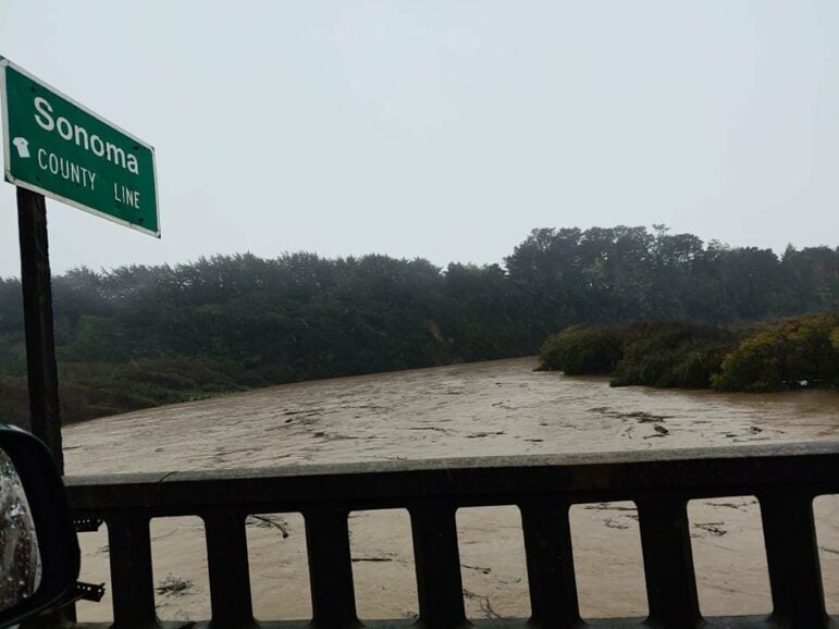
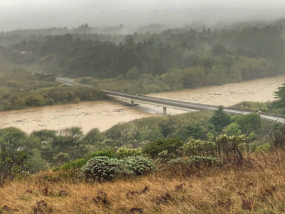
UPDATE 5:15 p.m. — SR 1 is closed at the Garcia River due to flooding, with no estimated time of re-opening; you can see the current conditions at the Caltrans traffic camera here. Additionally, it is likely that both the Russian River near Hopland and the Navarro River will rise above flood levels, along with other smaller creeks and streams.
The Sheriff’s Office has sent out an alert encouraging residents to prepare for potential flooding, which includes not crossing standing water in the roadways, and to avoid any downed power lines. The Nixle alert is below, and all of our additional updates and our list of important information resources with current info from local agencies are included below.
NWS warns of potential for small stream and urban flooding as light rains continue through the evening. Anticipate flooding along roadways, debris, and downed trees. National Weather Service has issued Flood Watches for the following two areas: Russian River at Hopland (HOPC1): https://inws.ncep.noaa.gov/a/a.php?i=62846280 Navarro River at Navarro (NVRC1): https://inws.ncep.noaa.gov/a/a.php?i=62859196 Possiblity of flooding on HWY 175 and HWY 128. Road Closures: State Route 1 closed near Garcia River at post mark 17.5 – 18.5 due to flooding. No estimated time of opening. CalTrans and Mendocino County DOT have been responding to debris throughout the day. Remember, never drive through flood waters. If you see a downed power line, assume it is energized and extremely dangerous. Do not touch or try to move it—keep children and animals away. Report downed power lines immediately by calling 911 and by calling PG&E at 1-800-743-5002. PG&E continues to restore all power outages as they occur. Go to https://www.pge.com/ to view latest power outages and preparedness information. DEBRIS FLOW WARNING SIGNS: Listen and watch for rushing water, mud, and/or unusaual sounds. Unusual sounds, such as trees cracking or boulders knocking togther, might indicate moving debris. A faint rumbling sound that increases in volume is noticeable as landslides near. Movement of fences, retaining walls, utility poles, boulders, or trees. Report debris flows to 9-1-1 Again, please use caution if you’re driving and stay home if possible. Don’t Drown, Turn Around! Thank you Mendocino County!

UPDATE 4 p.m. — Travel continues to be impacted by falling trees and debris, and vehicle accidents or vehicles off the road have been ongoing all day in Mendocino, Lake and Humboldt counties and across the region. As of now, State Route 1 is closed at the Garcia River due to flooding, according to an alert from Caltrans.
The Russian River (check levels here) and Navarro River (check levels here) are continuing to rise and both may reach above flood levels over the next 24 hours, as well as other smaller creeks and streams in low lying areas, which could close highways. The most recent official information about specific roads can be found at our list of resources at the bottom of this article.
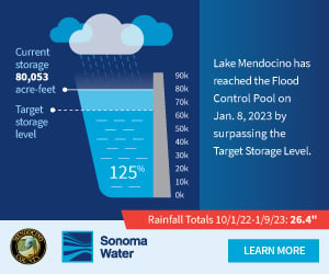
Photos of rain, minor flooding and rising rivers have been circulating since this morning, and the Army Corps of Engineers have shared some photos of water levels at Lake Mendocino here:
Here’s a short video we took to illustrate the rising waters from around 3 p.m. on East Commercial Street near Lenore St. in Willits:
UPDATE 1 p.m. — The storm has brought significant debris and flooding to the region’s roadways, and the California Highway Patrol’s current incident page is full of vehicle accidents and reports of rocks and water in the roads. Emergency responders are moving quickly from incident to incidents to help motorists and put signage in place warning of flooding and other road dangers, but we recommend that residents stay home if at all possible today, and take extreme caution on the road if you need to go out.
There are currently accidents on State Route 20, and there have been numerous reports of vehicles off the roadway or debris in the road on State Route 128, U.S. Highway 101, State Route 162, Orr Springs Road, and a number of smaller roadways in the region. There trees or slides reported blocking roadways on the Comptche-Ukiah Road, Mill Creek Road in Ukiah, and a number of other places, The storm is expected to intensify over the next couple hours, and river flows will continue to rise after the rains have subsided, so residents should prepare for increased flooding over the course of the day.
We’ll continue to update, but we recommend checking the links below for the most current information — there are enough vehicle accidents and roadway debris right now that we will be unable to report on each individually. as conditions are changing rapidly.
MENDOCINO Co., 10/24/21 — Heavy rains arrived on the North Coast late Saturday night and are expected to continue through Monday morning, bringing a volume of water to our local waterways that is significantly above average for a typical October, and due to the ongoing drought these heavy rains could result in flooding in burn scars, low lying or flood-prone areas, overflowing of small creeks and streams, and rapidly rising rivers. Driving conditions are already difficult, with high winds and significant debris, rocks, and tree branches being reported on the roadways. Residents are urged to prepare for possible flooding and avoid travel if possible.
There has already been significant rain and high winds overnight and the storm system is expected to bring between four to eight inches of total precipitation over the next day. The National Weather Service (NWS) has issued a flood watch for the area around State Route 175 in Hopland, as the Russian River flows are expected to rise rapidly, and flooding is also possible in the vicinity of Hopkins Fire burn scar in Calpella. The NWS has also placed the majority of Mendocino County and northeastern Lake County under a flood watch, noting that as of this morning, between two and five inches of rain had fallen, and another one to three inches are expected over the day — read the details here. High surf of up to 30 feet waves is also anticipated for the coast through Tuesday.
The Mendocino County Sheriff’s Office (MSCO) has encouraged residents to prepare for flooding and power outages as needed. Sandbags are available at the Willits Police Station, hardware stores, and other locations around the county (we will continue to update). If you encounter flooded roadways or standing water in the road, do not attempt to drive through, and remember that any downed power lines may be still be live.
This storm is significantly above average in terms of strength and anticipated rainfall, as outlined by this explanation from the National Weather Prediction Center:
In parts of Northern California, local officials have issued evacuation warnings for burn scar areas in anticipation of possible debris flows, and a number of small streams and rivers may overflow their banks. Across the North Coast similar warnings have been issued, and the Eel River is also expected to flood at Fernbridge.
You can see the current wind totals here, and the current rain fall amounts here. NWS is collecting storm and damage reports from residents at this link. We will continue to update throughout the day, and we’ve put together a number of official websites and resources that we recommend for the most current official reports below.
Here’s some important resources to check for the most current information, as well as our general emergency resource guide. We will continue to update you as conditions change, and the most specific information from official agencies for your location can be found on these sites:
- General power shut-off information from PG&E
- Check the current NWS weather forecast and fire warnings for your location at the NWS weather website
- Mendocino County’s new emergency map, Mendoready.org, which will show current info about evacuations and more
- Mendocino County Sheriff’s Office Nixle webpage
- Mendocino County Sheriff’s Office Twitter and Facebook
- Mendocino County Sheriff’s Office MendoAlert for emergency notifications, sign up for it here.
- Current road conditions can be checked at the Caltrans’ “quick map”
- Caltrans traffic cameras and other travel information
- California Highway Patrol’s current incident page
- USGS current conditions for stream flows in Mendocino County
- California Nevada River Forecast Center map showing current stream flows at risk of flooding
- NWS river observation website
- USGS map of post- wildfire debris-flow risk areas
- Mendocino Voice emergency “need to know” information resources guide, with lots of information about emergency alerts, disaster preparedness, and more


That’s the Gualala River and Bridge, not the Garcia.
sorry for the bad news
Yes as stated above the photos of the “Garcia River” are actually photos of the Gualala River in the town of Gualala along the Sonoma/ Mendocino county line. The Garcia River flood plain is north in Manchester / Point Arena and I like this photo is actually flooded.
thanks it’s been corrected!
The picture at the top of the story is not the Garcia River crossing. Maybe the Gualala River.